The Gila National Forest west of Beaverhead, New Mexico has many off road bicycle riding possibilities. After a recent trip to the area with the Santa Fe Road riders I scouted out possible routes (and camping places) for the future. Here is an annotated GPS track of my wanderings  in the area.
The Very Large Array, part of the National Radio Astronomy Observatory is near Magdalena, New Mexico. It is located near the north end of NM52 just off of US60, one of the main entrances to the Gila National Forest Country. Stopping at the Visitor Center is always worthwhile. See link for details.
Here are two views of the VLA on different days. The second view is from high in the south along NM52. NM52 would make a good gravel grinder, but the distances are very long. The VLA to Winston is about 60 miles. NM163, described below, starts about 19 miles south of the VLA. It would also be a phenomenal gravel ride, but is it runs about 60 miles beyond that intersection to Beaverhead, very long, isolated and has absolutely no services.
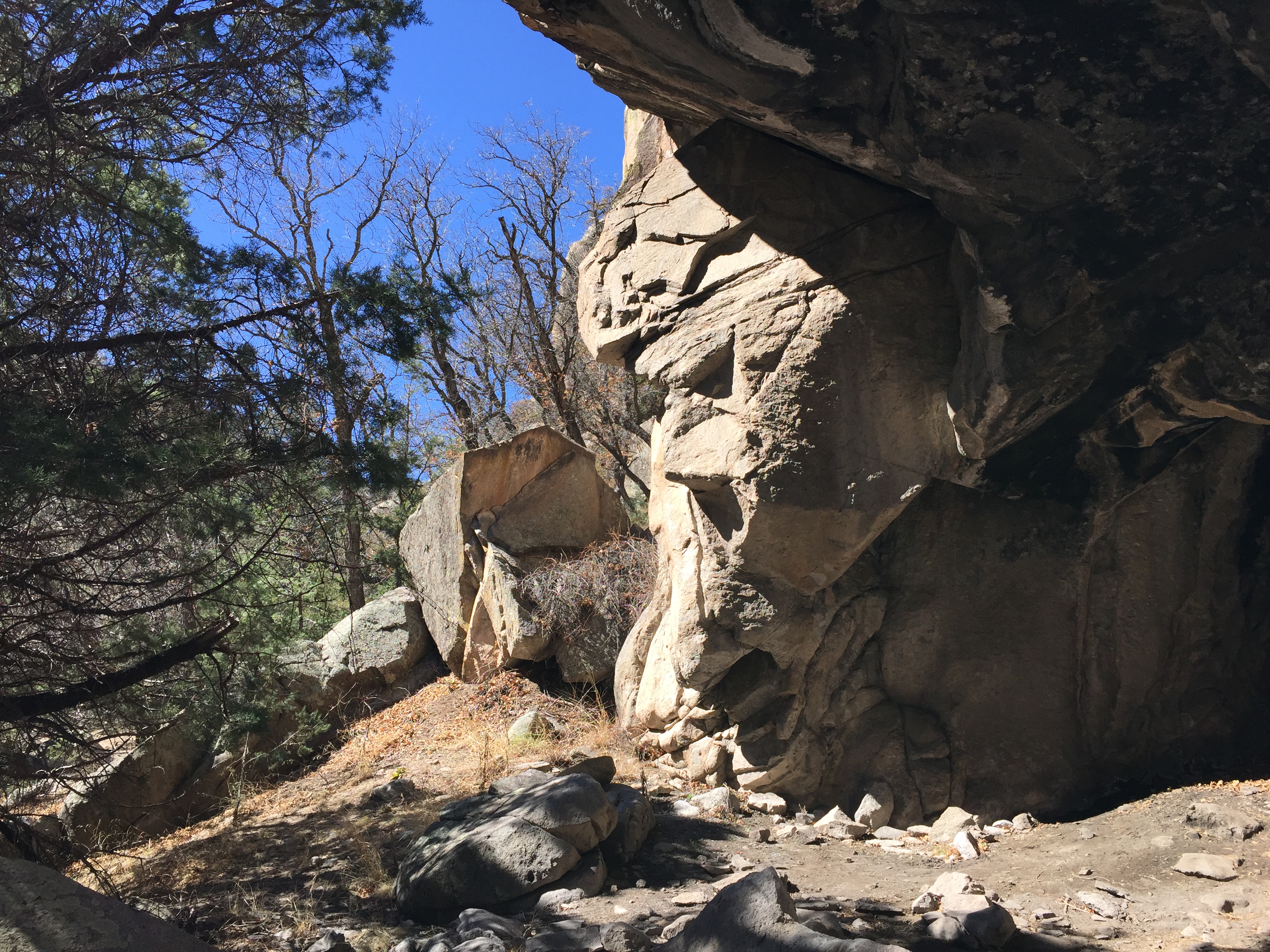
Chloride Canyon, aka the Wall Canyon Road, is a wonderful mountain bike ride. Start in either Winston or Chloride itself and ride up to the Continental Divide. 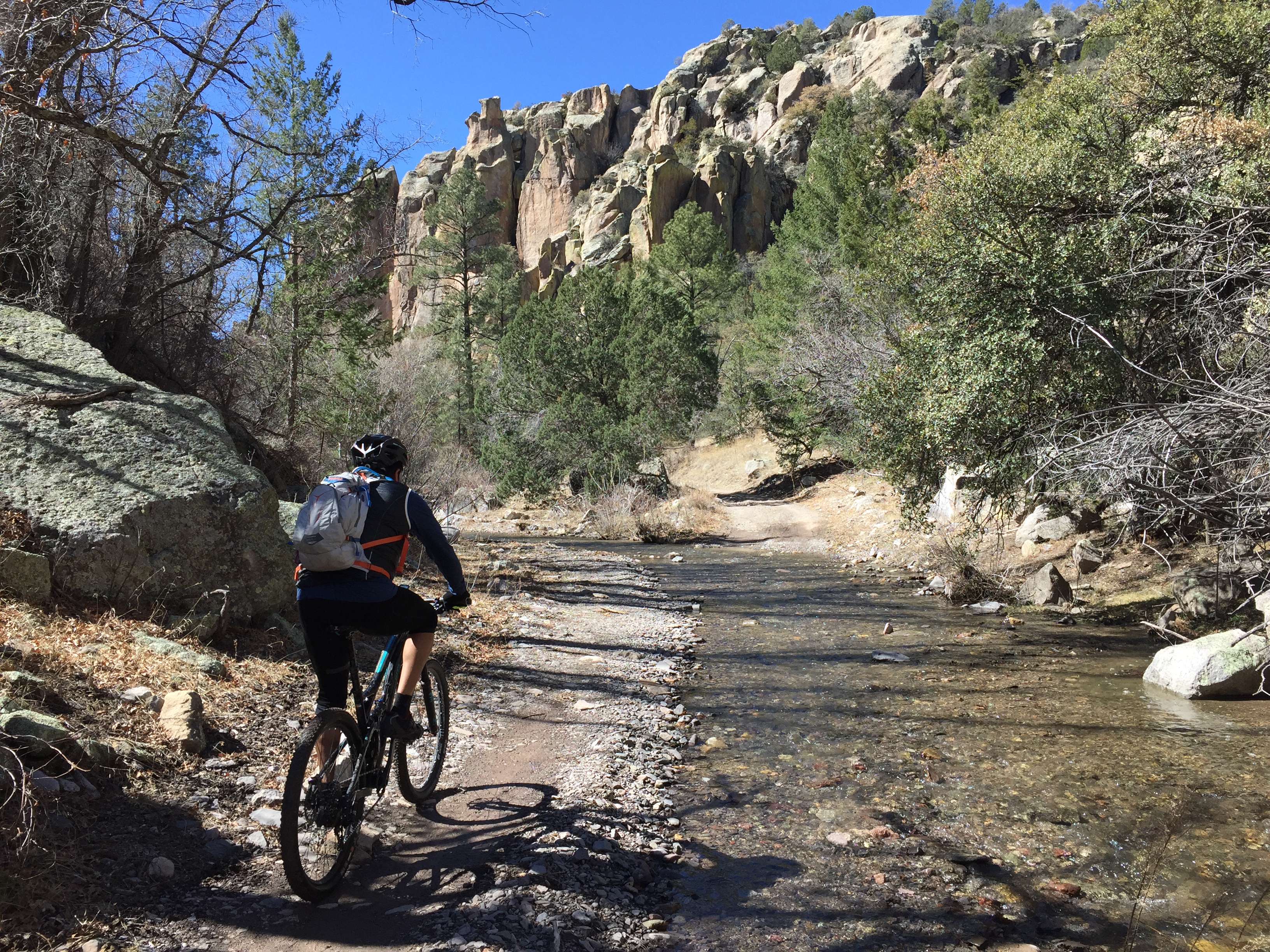 The road crosses the creek many, many times, so if water is flowing you will get wet. This is Steve Fong enjoying the water. There are old mine claims, abandoned ghost town buildings and petroglyphs on the way up. You can actually ride all the way through to the pavement on NM59 and arrive at Burnt Cabin Flat, but this is likely too far for an out-and-back. This is an MTB ride and not a gravel grinder. It’s too much for small tires and high gears.
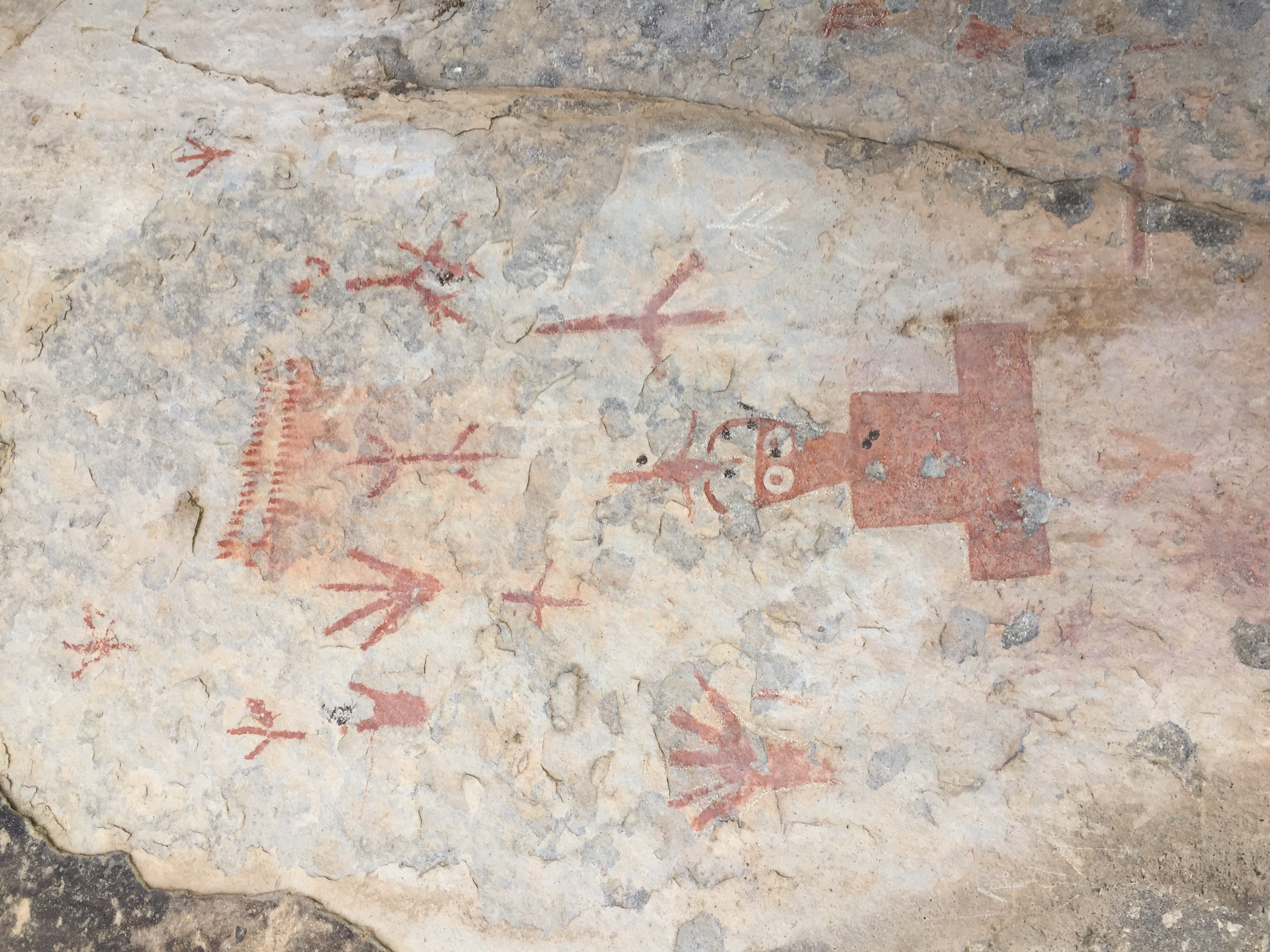 Watch for petroglyphs on the north side about half way up.
A more detailed GPS track of Chloride Creek.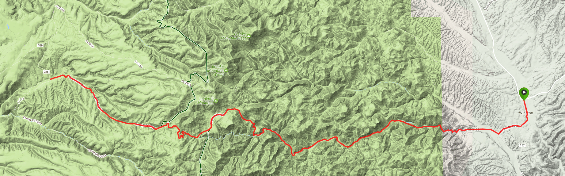
Beaverhead Ranger Station at the end of the pavement on NM59, makes a good starting point for the dirt roads in the North Gila.  The Wall Lake/North Star Mesa road is part of the GERONIMO TRAIL NATIONAL SCENIC BYWAY, connecting Beaverhead and San Lorenzo. But portions of the road are clay mud and simply impassable when wet or snowy, especially in the deep shaded canyons which hide the snow well into the spring. It connects NM35 in the Mimbres Valley with the the Beaverhead Station. I have tried this road two separate years in late February and could not get through, but when dry, it is a fine road. This road would make a very good gravel grinder if you camped anywhere along the road.
NM59 west of the Beaverhead Ranger Station (the Snow Lake Road) is gravel. It is maintained (sorta) for about 10 miles west of the station, but maintenance stops at the end of the NM State section and the road quickly becomes impassable in wet weather.  In dry weather it’s a fine narrow road. This road would make a very good gravel grinder if you were camped near Beaverhead.
Much of the Gila now Mexican Grey Wolf Territory. (This version of WordPress still doesn’t handle the EXIF data in photos correctly, so you have to look at this pic sideways)
The Snow Lake road passes a wonderful Forest Service Campground about 5 miles west of Beaverhead, the Wolf Hollow Camp.

There is one road that leads north from Beaverhead. After about five miles through private ranch land it splits near “The Turkey Track.” NM163 proceeds northeast. This is a good maintained gravel road, but can have slippery stretches in wet weather.  It meets up with NM52 about 19 miles south of the VLA. If you can’t get out of the the Beaverhead area over the other roads, this one is usually passable. NM163 would also make a very good gravel grinder, but it is very long, more than 60 miles from NM52 to Beaverhead. It is however extremely scenic in a New-Mexico-High-Desert-Way and is worthwhile to drive or ride portions. The Continental Divide Trail passes through here.
The other three roads, the north road to Snow Lake, the Collins Park Road and County Road 16 are all treacherous when wet or snowy. Each of these roads goes through to pavement in good weather, but I was unable to drive through in late February. Each of these roads would make possible a bike-packing connection to pavement during nice weather.